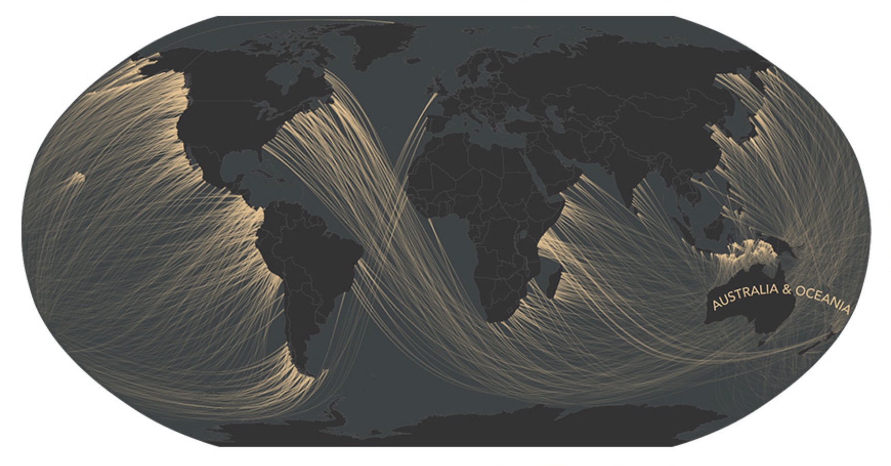
Andy Woodruff is a cartographer, he makes maps. His most recent construction is a series of whimsical maps that visualize what many off us at least once in our lives may have pondered.
When we are at the beach looking out to sea, casting our eyes to the distant horizon, we often wonder what lies beyond. If you could set off and walk in a straight line from your small plot of sand (or rock) across the vast ocean where would you first make landfall? Andy Woodruff’s “Beyond the Sea” maps answer this question, and the results are surprising.
For instance, if you happen to be looking out from any beach on the US Eastern Seaboard — and your vision could bend and stretch over the horizon — you would see the Southern coastline of Australia. So, drop the boring atlas and Google Maps and go follow some more of Andy Woodruff’s fascinating great circles.
From NPR:
Ever stood on the coastline, gazing out over the horizon, and wondered what’s on the other side? Pondered where you’d end up if you could fly straight ahead until you hit land?
Turns out the answer might be surprising. And even if you pulled out an atlas — or, more realistically, your smartphone — you might have trouble figuring it out. Lines of latitude won’t help, and drawing a path on most maps will lead you astray.
Cartographer Andy Woodruff, who recently embarked on a project called Beyond the Sea to illustrate this puzzle, says there are two simple reasons why it’s harder than it seems to figure out which coast lies directly on the other side of the horizon.
First, coastlines are “wacky,” he writes on his blog. And second, well, the Earth is round.
The crookedness of the world’s coastlines means moving a few miles up or down the coast will leave you facing a different direction (assuming your gaze is straight out, perpendicular to the coast around you).
Read the entire story here.
Map: Beach view of Australia. Courtesy Andy Woodruff.
