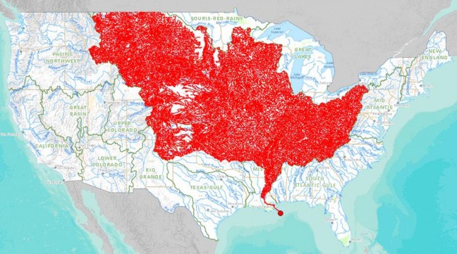
 The system of streams and tributaries that feeds the great Mississippi river is a complex interconnected web covering around half of the United States. A new mapping tool puts it all in one intricate chart.
From Slate:
A new online tool released by the Department of the Interior this week allows users to select any major stream and trace it up to its sources or down to its watershed. The above map, exported from the tool, highlights all the major tributaries that feed into the Mississippi River, illustrating the river’s huge catchment area of approximately 1.15 million square miles, or 37 percent of the land area of the continental U.S. Use the tool to see where the streams around you are getting their water (and pollution).
See a larger version of the map here.
Image: Map of the Mississippi river system. Courtesy of Nationalatlas.gov.
