Tag Archives: California

Earth Day 2016: Silicon Swamp Edition

NOAA-Silicon-Valley-seal-level-rise-map

How better to mark this year’s Earth Day than to remind ourselves of the existential perils of climate change. As the Earth warms, polar ice melts, sea-levels rise. As sea-levels rise, low lying coastal lands submerge. Much of coastal Florida would disappear under a sea-level rise of a mere 6 feet.

Our tech innovation hub in Silicon Valley wouldn’t fare well either. Many of our tech giants, including Google, Facebook, Oracle, Cisco and Salesforce, have planted their roots on the bay-side of Silicon Valley. Much of this area is only a handful of feet above sea-level. Oh, and kiss goodbye to San Francisco International Airport as well — though perhaps the local VCs could re-purpose it into a sea-plane terminal.

The map above, courtesy of National Oceanic and Atmospheric Administration (NOAA), highlights the flood prone areas in shades of blue.

From the Guardian:

Technology giants including Facebook and Google face the prospect of their prestigious Silicon Valley headquarters becoming swamped by water as rising sea levels threaten to submerge much of the property development boom gripping San Francisco and the Bay Area.

Sea level forecasts by a coalition of scientists show that the Silicon Valley bases for Facebook, Google and Cisco are at risk of being cut off or even flooded, even under optimistic scenarios where rapid cuts in greenhouse gas emissions avoid the most severe sea level increases.

Without significant adaptation, Facebook’s new campus appears most at risk. The 430,000 sq ft complex – topped with a nine-acre garden rooftop – is an extension of its Menlo Park base and was crafted by architect Frank Gehry. Located near the San Francisco Bay shoreline, the offices are designed to house 2,800 staff.

“Facebook is very vulnerable,” said Lindy Lowe, a senior planner at California’s Bay Conservation and Development Commission. “They built on a very low site – I don’t know why they chose to build there. Facebook thinks they can pay enough to protect themselves.

“The temporary flooding within the campus can probably be addressed, but the temporary flooding onto the roadway can’t be addressed by them. I think they realize that is the weakest link for them. We’ll see how dedicated they are to that facility.”

Facebook has elevated its office to spare it from flooding, but even with a 1.6ft rise in sea levels by the end of the century – which is towards the lower end of projections – the area around it will be inundated. Much sooner, within the coming decades, the roads leading into the complex will flood so regularly that major adaptions will be required to keep the site viable. Facebook didn’t respond to repeated requests to comment on the issue.

The situation is a little better for Google, located in Mountain View and also unwilling to discuss sea level rise, and Cisco, headquartered in San Jose. But should the Antarctic ice sheet disintegrate, as outlined in a recent scientific paper, seas will be pushed up beyond 6ft and swamp both businesses.

The situation is similarly stark for Salesforce, which would see its San Francisco base submerged under the worst sea level rise scenario. Meanwhile, Airbnb, located near the vulnerable Mission Bay area, will have its headquarters gain a much closer bayside view simply by staying put.

Read the entire store here.

Image: Sea-level rise and coastal flooding impacts, San Francisco / Bay Area map. Courtesy of NOAA.

One Spinach Leaf = 1 Gallon of Water

spinach-leaves

As I leafed through this article from the New York Times my jaw progressively dropped. The story and the underlying analysis brings the terrible Californian drought in to a very clear focus. The increasing lack of water in the state is causing policy makers to enact ever-tougher water restrictions and forcing farmers and consumers to use less and less of the precious liquid.

While the problem in California pales in comparison to the human cost of past global droughts in Africa and Asia, the situation nonetheless is becoming increasingly dire, especially for farmers and those who depend on their produce (most of us). I’ve been following developments in California for sometime, but I must admit until now I had never pondered the actual cost, in terms of water, of some of the foods I eat. Soul-searching required.

So, here’s a quick snapshot from some of the mountains of data:

The average American consumes over 300 gallons of California water each week by eating food that was produced there.

One spinach leaf — yes, one — requires just under 1 gallon of water to grow until ripe for eating.

It takes 4.1 gallons of water to produce a slice of California avocado each week, which is what an average American eats each week.

It takes over 1 gallon of water to produce ONE California almond.

It takes 42.5 gallons of water to produce 3 mandarin oranges.

Four glasses of milk require almost 144 gallons of water (most of this goes to growing the feed for the cattle that produce our milk and beef).

A handful of strawberries needs 1 gallon of water.

Check out the detailed research here.

Image: Spinach leaves. Public domain.

The Original Rolling Stones

rocks-at-racetrack_arno_gourdol

Who or what has been moving these Death Valley boulders? Theories have persisted for quite some time: unknown inhabitants of the desert straddling California and Nevada; mischievous troglodytes from Middle Earth; aliens sending us cryptic, geologic messages; invisible demons; telepathic teenagers.

But now we know, and the mysterious forces at work are, unfortunately, rather mundane — the rocks are moved through a combination of rain, ice and wind. Oh well — time to focus on crop circles again!

From ars technica:

Mario is just a video game, and rocks don’t have legs. Both of these things are true. Yet, like the Mario ghosts that advance only when your back is turned, there are rocks that we know have been moving—even though no one has ever seen them do it.

The rocks in question occupy a spot called Racetrack Playa in Death Valley. Playas are desert mudflats that sometimes host shallow lakes when enough water is around. Racetrack Playa gets its name from long furrows extending from large rocks sitting on the playa bed—tracks that make it look as if the rocks had been dragged through the mud. The tracks of the various rocks run parallel to each other, sometimes suggesting that the rocks had made sharp turns in unison, like dehydrated synchronize swimmers.

Many potential explanations have been offered up (some going back to the 1940s) for this bizarre situation, as the rocks seem to only move occasionally and had never been caught in the act. One thing everyone could agree on was that it must occur when the playa is wet and the muddy bottom is slick. At first, suggestions revolved around especially strong winds. One geologist went as far as to bring out a propeller airplane to see how much wind it would take.

The other idea was that ice, which does occasionally form there, could be responsible. If the rocks were frozen into a sheet of ice, a little buoyancy might reduce the friction beneath them. And again, strong winds over the surface of the ice could drag the whole mess around, accounting for the synchronized nature of the tracks.

Over the years, a number of clever studies have attempted to test these possibilities. But to truly put the question to rest, the rocks were going to have to be observed while moving. A team led by Richard Norris and his engineer cousin James Norris set out to do just that. They set out 15 rocks with GPS loggers, a weather station, and some time-lapse cameras in 2011. Magnetic triggers were buried beneath the rocks so that the loggers would start recording when they began to move. And the Norrises waited.

They got what they were after last winter. A little rain and snow provided enough water to fill the lake to a depth of a few centimeters. At night, temperatures were low enough for ice to form. On a few sunny days, the rocks stirred.

By noon, the thin sheet of ice—just a few millimeters thick—would start breaking up. Light wind pushed the ice, and the water in the lake, to the northeast. The rocks, which weren’t frozen into the thin ice, went along for the ride. On one occasion, two rocks were recorded traveling 65 meters over 16 minutes, with a peak rate of 5 to 6 meters per minute.

These movements were detectable in the time-lapse images, but you might not actually notice it if you were standing there. The researchers note that the tracks carved in the mud aren’t immediately apparent due to the muddy water.

The total distances traveled by the instrumented rocks between November and February ranged from 15 to 225 meters. While all moving rocks travel in the direction of the prevailing wind, they didn’t all move together—motion depended on the way the ice broke up and the depth of the water around each rock.

While the proposed explanations weren’t far off, the thinness of the ice and the minimal wind speed that were needed were both surprises. There was no ice buoyancy lifting the rocks. They were just being pushed by loose sheets of thin ice that were themselves being pushed by wind and water.

In the end, there’s nothing extraordinary about the motion of these rocks, but the necessary conditions are rare enough that the results still shock us. Similar tracks have been found in a few playas elsewhere around the world, though, and ice-pushed rocks also leave marks in the shallows of Canada’s Great Slave Lake. There’s no need to worry about the rocks at Racetrack Playa coming to life and opening secretly ferocious jaws when you look away.

Read the entire story here.

Image: Rocks at Racetrack Playa, Death Valley. Courtesy of Arno Gourdol. Some Rights Reserved.

The Persistent Threat to California

california-drought

Historians dispute the etymology of the name California. One possible origin comes from the Spanish Catalan phrase which roughly translates as “hot as a lime oven”. But while this may be pure myth there is no doubting the unfolding ecological (and human) disaster caused by incessant heat and lack of water. The severe drought in many parts of the state is now in its third year, and while it is still ongoing it is already recorded as the worst in the last 500 years. The drought is forcing farmers and rural communities to rethink and in some cases resettle, and increasingly it also threatens suburban and urban neighborhoods.

From the NYT:

The punishing drought that has swept California is now threatening the state’s drinking water supply.

With no sign of rain, 17 rural communities providing water to 40,000 people are in danger of running out within 60 to 120 days. State officials said that the number was likely to rise in the months ahead after the State Water Project, the main municipal water distribution system, announced on Friday that it did not have enough water to supplement the dwindling supplies of local agencies that provide water to an additional 25 million people. It is first time the project has turned off its spigot in its 54-year history.

State officials said they were moving to put emergency plans in place. In the worst case, they said drinking water would have to be brought by truck into parched communities and additional wells would have to be drilled to draw on groundwater. The deteriorating situation would likely mean imposing mandatory water conservation measures on homeowners and businesses, who have already been asked to voluntarily reduce their water use by 20 percent.

“Every day this drought goes on we are going to have to tighten the screws on what people are doing” said Gov. Jerry Brown, who was governor during the last major drought here, in 1976-77.

This latest development has underscored the urgency of a drought that has already produced parched fields, starving livestock, and pockets of smog.

“We are on track for having the worst drought in 500 years,” said B. Lynn Ingram, a professor of earth and planetary sciences at the University of California, Berkeley.

Already the drought, technically in its third year, is forcing big shifts in behavior. Farmers in Nevada said they had given up on even planting, while ranchers in Northern California and New Mexico said they were being forced to sell off cattle as fields that should be four feet high with grass are a blanket of brown and stunted stalks.

Fishing and camping in much of California has been outlawed, to protect endangered salmon and guard against fires. Many people said they had already begun to cut back drastically on taking showers, washing their car and watering their lawns.

Rain and snow showers brought relief in parts of the state at the week’s end — people emerging from a movie theater in West Hollywood on Thursday evening broke into applause upon seeing rain splattering on the sidewalk — but they were nowhere near enough to make up for record-long dry stretches, officials said.

“I have experienced a really long career in this area, and my worry meter has never been this high,” said Tim Quinn, executive director of the Association of California Water Agencies, a statewide coalition. “We are talking historical drought conditions, no supplies of water in many parts of the state. My industry’s job is to try to make sure that these kind of things never happen. And they are happening.”

Officials are girding for the kind of geographical, cultural and economic battles that have long plagued a part of the country that is defined by a lack of water: between farmers and environmentalists, urban and rural users, and the northern and southern regions of this state.

“We do have a politics of finger-pointing and blame whenever there is a problem,” said Mr. Brown. “And we have a problem, so there is going to be a tendency to blame people.” President Obama called him last week to check on the drought situation and express his concern.

Tom Vilsack, secretary of the federal Agriculture Department, said in an interview that his agency’s ability to help farmers absorb the shock, with subsidies to buy food for cattle, had been undercut by the long deadlock in Congress over extending the farm bill, which finally seemed to be resolved last week.

Mr. Vilsack called the drought in California a “deep concern,” and a warning sign of trouble ahead for much of the West.

“That’s why it’s important for us to take climate change seriously,” he said. “If we don’t do the research, if we don’t have the financial assistance, if we don’t have the conservation resources, there’s very little we can do to help these farmers.”

The crisis is unfolding in ways expected and unexpected. Near Sacramento, the low level of streams has brought out prospectors, sifting for flecks of gold in slow-running waters. To the west, the heavy water demand of growers of medical marijuana — six gallons per plant per day during a 150-day period — is drawing down streams where salmon and other endangered fish species spawn.

“Every pickup truck has a water tank in the back,” said Scott Bauer, a coho salmon recovery coordinator with the California Department of Fish and Wildlife. “There is a potential to lose whole runs of fish.”

Without rain to scrub the air, pollution in the Los Angeles basin, which has declined over the past decade, has returned to dangerous levels, as evident from the brown-tinged air. Homeowners have been instructed to stop burning wood in their fireplaces.

In the San Joaquin Valley, federal limits for particulate matter were breached for most of December and January. Schools used flags to signal when children should play indoors.

“One of the concerns is that as concentrations get higher, it affects not only the people who are most susceptible, but healthy people as well,” said Karen Magliano, assistant chief of the air quality planning division of the state’s Air Resources Board.

The impact has been particularly severe on farmers and ranchers. “I have friends with the ground torn out, all ready to go,” said Darrell Pursel, who farms just south of Yerington, Nev. “But what are you going to plant? At this moment, it looks like we’re not going to have any water. Unless we get a lot of rain, I know I won’t be planting anything.”

The University of California Cooperative Extension held a drought survival session last week in Browns Valley, about 60 miles north of Sacramento, drawing hundreds of ranchers in person and online. “We have people coming from six or seven hours away,” said Jeffrey James, who ran the session.

Dan Macon, 46, a rancher in Auburn, Calif., said the situation was “as bad as I have ever experienced. Most of our range lands are essentially out of feed.”

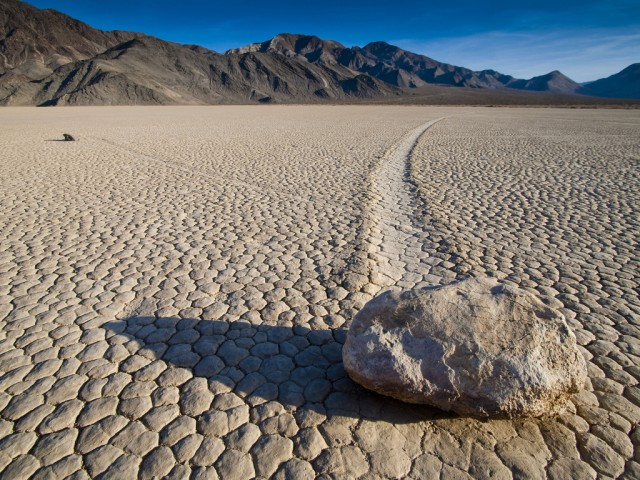
With each parched sunrise, a sense of alarm is rising amid signs that this is a drought that comes along only every few centuries. Sacramento had gone 52 days without water, and Albuquerque had gone 42 days without rain or snow as of Saturday.

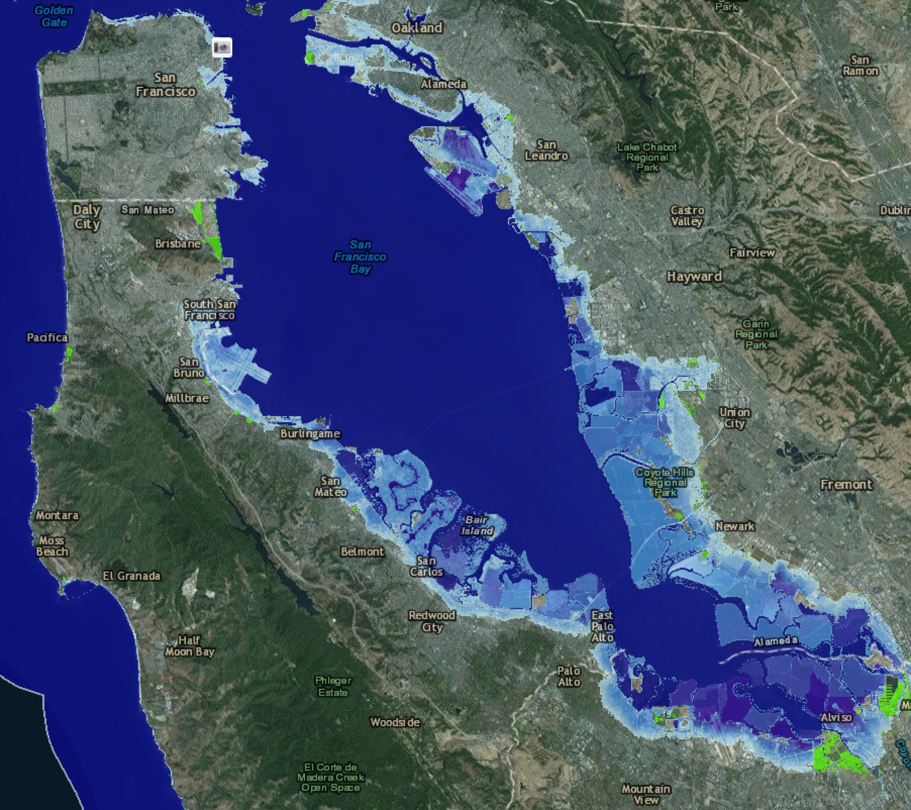
The snowpack in the Sierra Nevada, which supplies much of California with water during the dry season, was at just 12 percent of normal last week, reflecting the lack of rain or snow in December and January.

Read the entire article here.

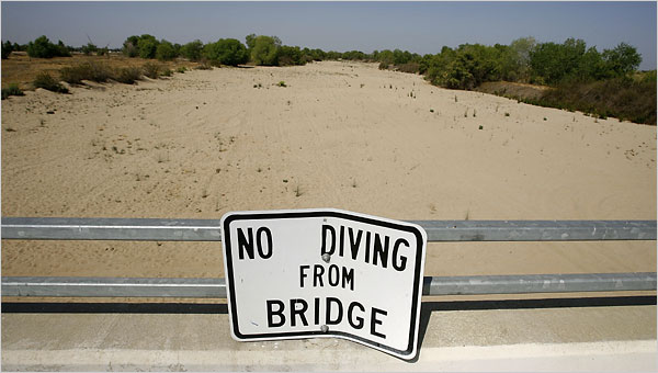
Image: Dry riverbed, Kern River in Bakersfield, California. Courtesy of David McNew/Getty Images / New York Times.